Springway Trail Plan
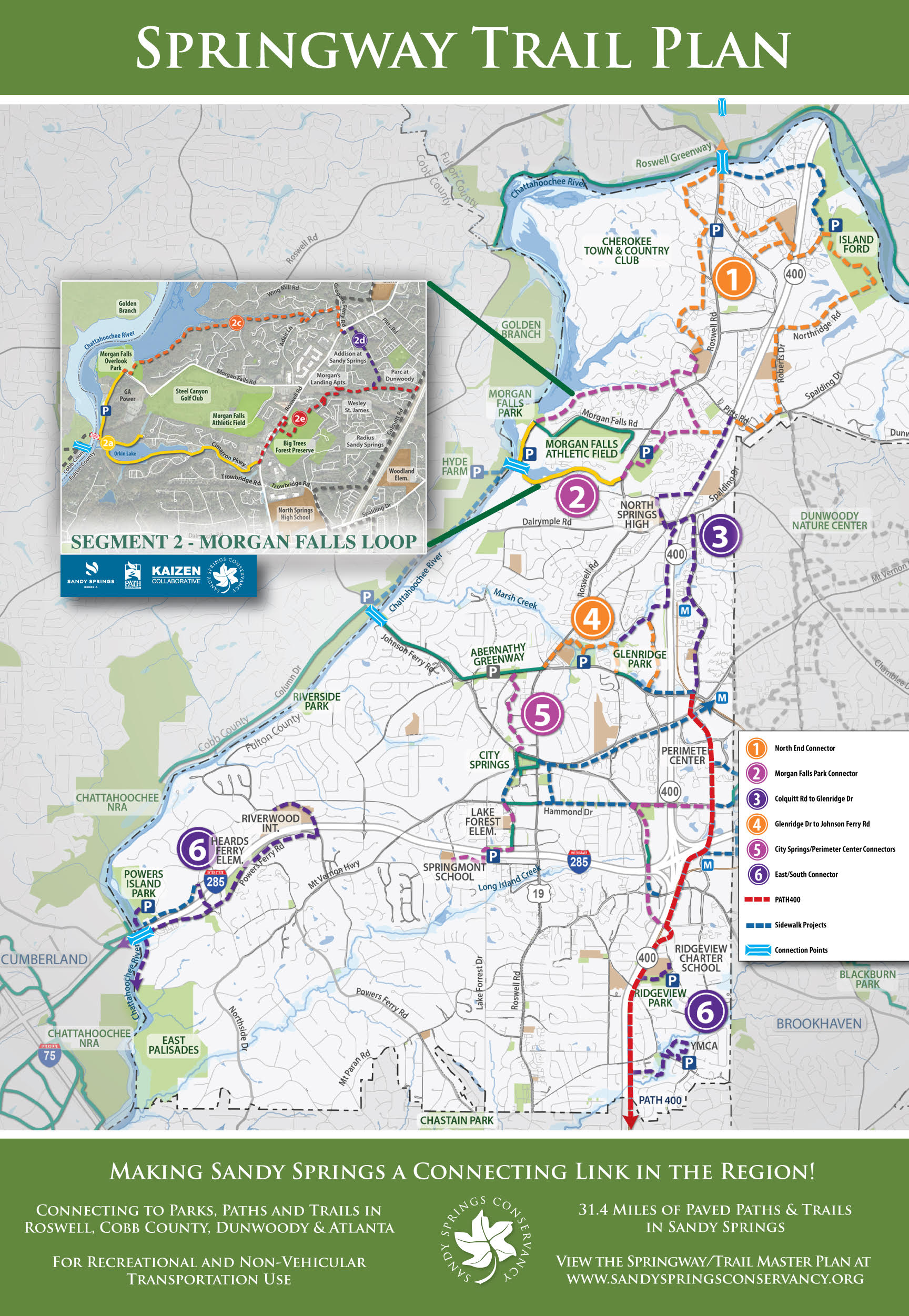
 Sandy Springs Conservancy was a driving force in the development of the Sandy Springs Trail Master Plan, now known as the Springway Trail Plan. The trail plan outlines a total of 31.4 miles of trails to connect parks and greenspace throughout the city to places where people live, work and gather. The plan serves as a road map for the development of connectivity trails broken down into 6 areas of the city with an implementation plan.
In January 2019 representatives of SSC met with city of Sandy Springs officials and pitched the idea of developing a master plan for a paved pedestrian trail system in Sandy Springs. SSC offered to contribute $25,000 toward the plan if the city was interested. The city agreed to move forward and funded the remaining $25,000 for the development of a trail master plan.
With SSC’s recommendation, PATH, an organization dedicated to developing trails throughout Georgia, was invited to participate in the development of a trail master plan for Sandy Springs. In 2019 a trail master plan committee was formed that included representatives from SSC, PATH and city staff. With input from all parties and the public, the plan was completed and adopted by the city in the fall of 2019. The city committed to building 10 miles of trails in the first 10 years. In 2023 the city named the trail plan “Springway.”
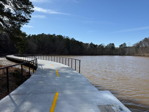
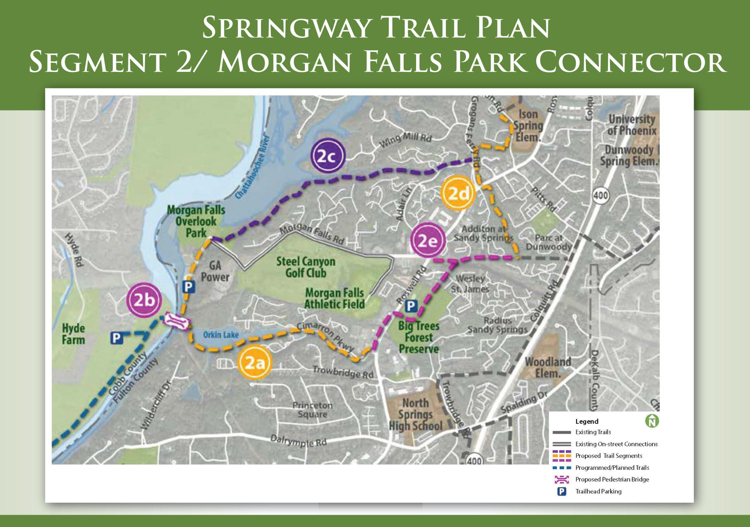
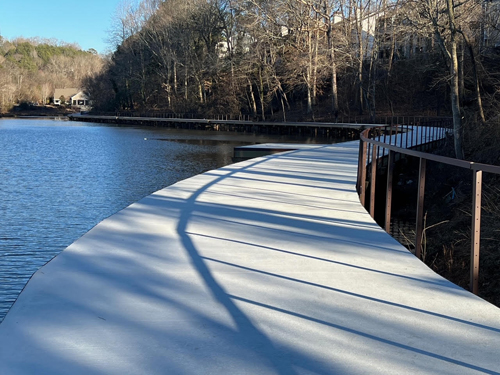
The Morgan Falls Park Connector was the first part of the Springway Trail Plan chosen by the city for construction. The Morgan Falls Park Connector is identified as Segment 2 on the trail plan map (see map below.) Segment 2 is a 5.4 mile loop connecting Morgan Falls Overlook Park, Big Trees Forest Preserve and the Chattahoochee River. Segment 2 is broken down into 4 sections for construction, 2A, 2C, 2D & 2E. Segment 2A was selected to be the first section for construction. Segment 2A is a 1.6 mile stretch that connects Overlook Park to Cimarron Pkwy to Roswell Rd. A highlight of Segment 2A is a scenic boardwalk along Orkin Lake.
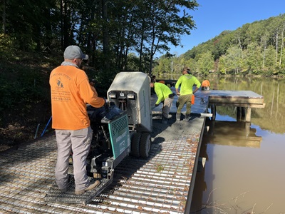
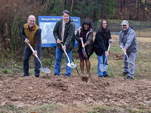 Funding for Segment 2A was approved by the city in January 2022. SSC contributed the required $30,000 in community support funds for the city to secure a $3M Georgia Outdoor Stewardship construction grant for the first segment. A groundbreaking for construction of Segment 2A took place in December 2022 near the Morgan Falls River Park/Dog Park.